


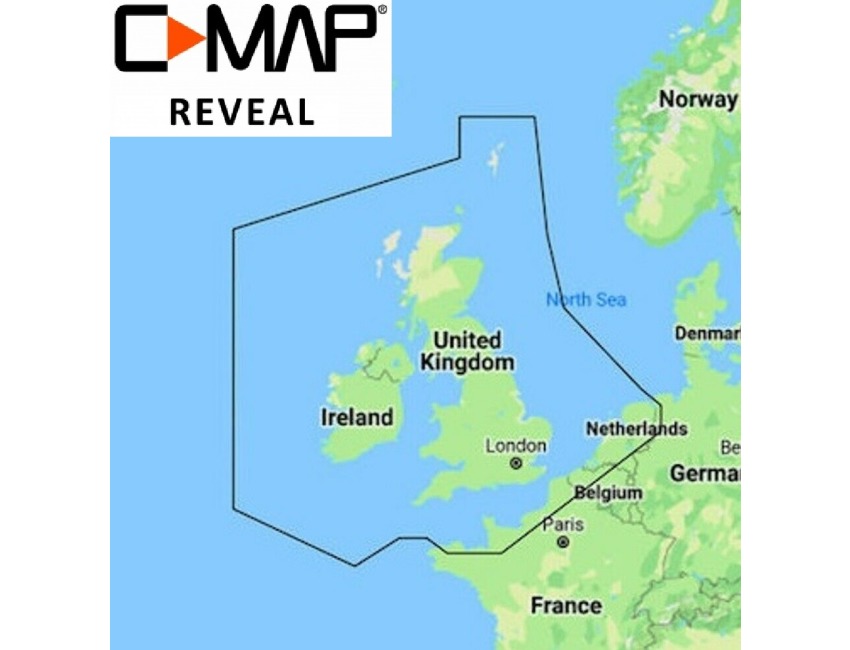
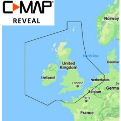
C-MAP REVEAL - UK & Ireland Chart - High Res Chart - M-EW-Y226-MS
Click to enlarge
Code184353083805
MPN M-EW-Y226-MS
Delivery Information
Currently we only deliver to the UK (inc. Northern Ireland), Channel Islands, Norway, Australia, New Zealand, Canada and USA for online ordering - please contact us on sales@bottomlinemarine.com if you live elsewhere.
Free shipping on UK orders over £75 (£5.95 for UK orders under £75)
Excludes certain heavy items
All prices include UK VAT - No customs or duty fees for UK orders
Description
C-MAP REVEAL - UK & Ireland
Designed for:
Lowrance Elite Ti2, HDS Gen3, HDS Live
Simrad Go, NSS Evo3
B&G Zeus2, Zeus3
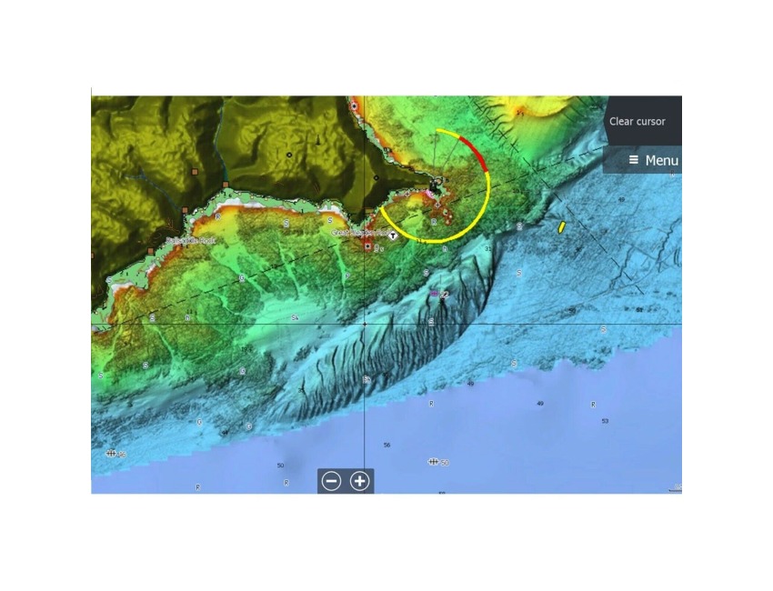
Whether cruising, fishing or sailing, C-MAP® REVEAL™ charts offer the very best of C-MAP. With Shaded Relief, including game-changing Reveal Seafloor Imagery, Aerial Photography, Satellite Overlay and Dynamic Raster Chart presentation added to the core C-MAP features found in DISCOVER™ – full-featured Vector Charts, with Custom Depth Shading, Tides & Currents and subscription-free Easy Routing™.
It also includes the very best of C-MAP High-Res Bathymetry, including integrated Genesis® data. Purchase includes 12 months of free online updates.
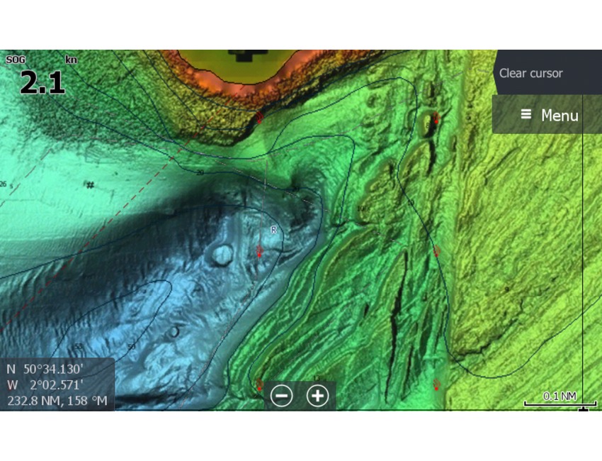
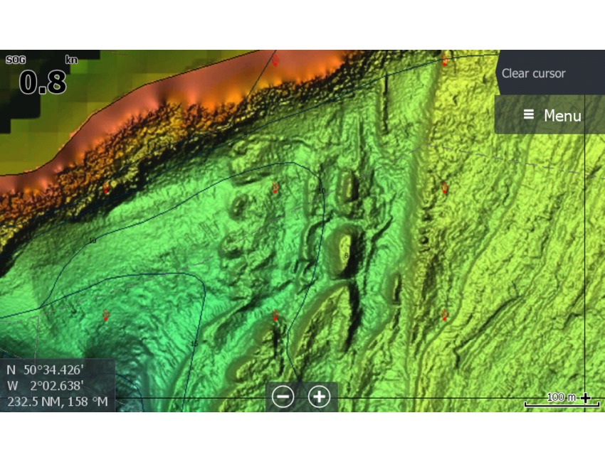
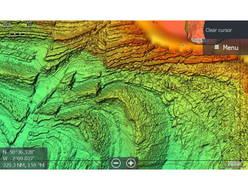
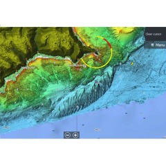
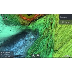
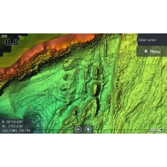
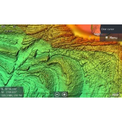
Shaded Relief – bring the world around you to life, with 3D rendered land and underwater elevation – including areas of Ultra-High-Res Bathymetric seafloor imagery, previously only available in MAX-N+ Reveal – a game-changer for anglers and divers.
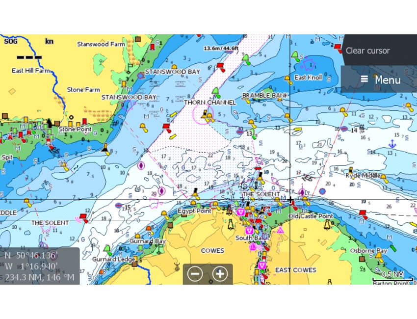
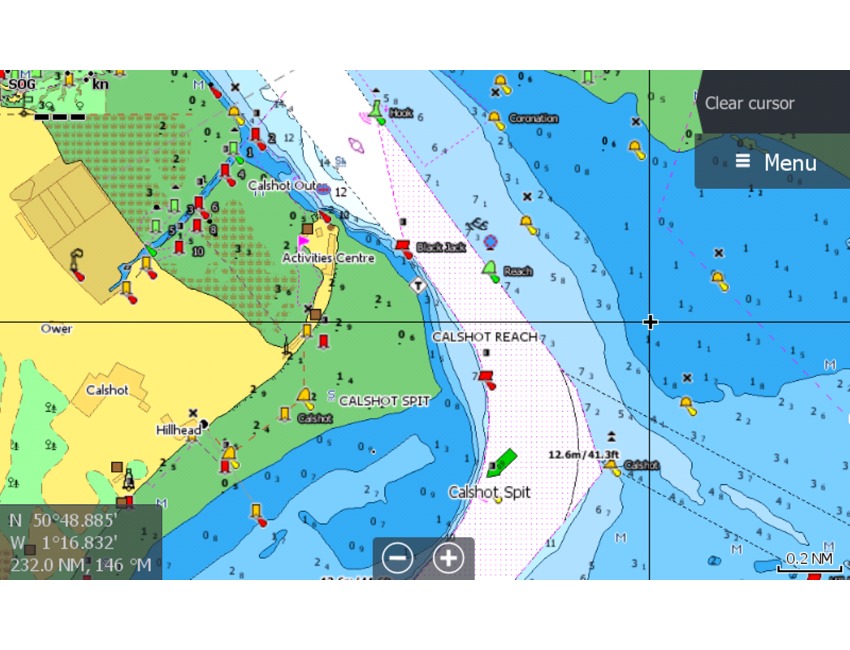
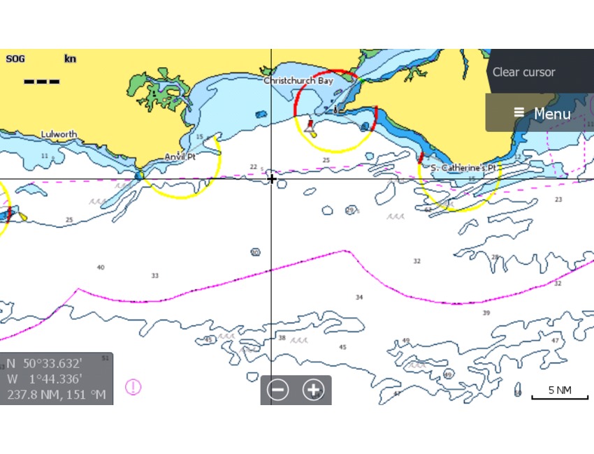
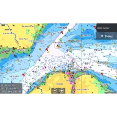
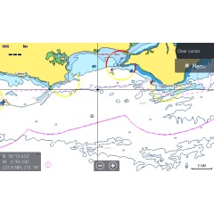
Full-Featured Vector Charts – making navigation easy by giving you accurate, up-to-date vector chart detail derived from official Hydrographic Office information.
High-Res Bathymetry – helps you identify shallow areas, drop-offs, ledges, holes or humps. Now includes compiled and quality-controlled Genesis® detail as part of singular HRB layer.
Custom Depth Shading – set a clear safety depth, maintain a paper-like view or create your own custom shading.
Dynamic Raster Charts – providing the traditional chart look and feel, coupled with easy access to all objects on the chart.
Easy Routing™ – helps you automatically plot the shortest, safest route based on detailed chart data and your personalized vessel information, with no subscription required.
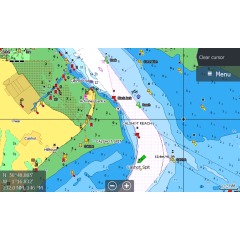
Aerial Photography – a collection of thousands of photos of marinas, harbors, inlets and other notable navigational features included to offer an additional level of detail.
Satellite Overlay – satellite imagery gives information about the surroundings when you find yourself in an unfamiliar place.
Tides & Currents – shows projections of water level and direction of tides to help plan your day out, cruising, angling or sailing.
Detailed Marina Port Plans – docking in an unfamiliar port is no problem when you have precise layouts of thousands of marinas, including slip spaces, restricted areas and other valuable navigation information.
Harbor & Approach Details – unprecedented level of detail. Approach any harbor and inlet with confidence. The perfect conclusion to a long voyage, sailing adventure or an exciting day of fishing.
Online Updates – keep your chart up to date, with 12 months’ free online updates.
Specification List
| Brand | C-MAP | Type | Cartography |
|---|